
Live flights
No-drone zones near airports in central Vietnam mapped on Google Earth
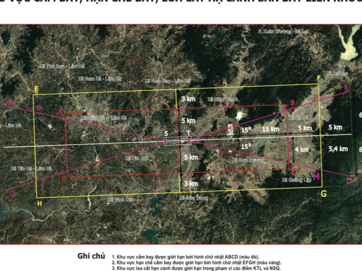
The military command of Lam Dong Province in Vietnam’s Central Highlands has mapped no-drone and restricted-flight zones around Lien Khuong International Airport and uploaded them to Google Earth to help protect aviation safety.
Read the full story at Tuoi Tre NewsOpen in the live monitor